

Size of this preview: 284 × 599 pixels. Other resolutions: 114 × 240 pixels | 227 × 480 pixels | 364 × 768 pixels | 485 × 1,024 pixels | 1,944 × 4,100 pixels.
Original file (1,944 × 4,100 pixels, file size: 1.33 MB, MIME type: image/png)
Regional maps of the Middle-earth Role Playing Game (MERP) 1982-1997. Infographic by Airyyn (2025) – Special thanks to Irwin. General map design by Peter C. Fenlon, Jr & Terry K. Amthor. All products and trademark are © Iron Crown Enterprises (I.C.E.).
File history
Click on a date/time to view the file as it appeared at that time.
| Date/Time | Thumbnail | Dimensions | User | Comment | |
|---|---|---|---|---|---|
| current | 15:09, 16 May 2026 | | 1,944 × 4,100 (1.33 MB) | Airyn (talk | contribs) | Second editions added (year 1987) + The Iron Wind (Mur Fostisyr) |
| 22:35, 10 March 2025 | 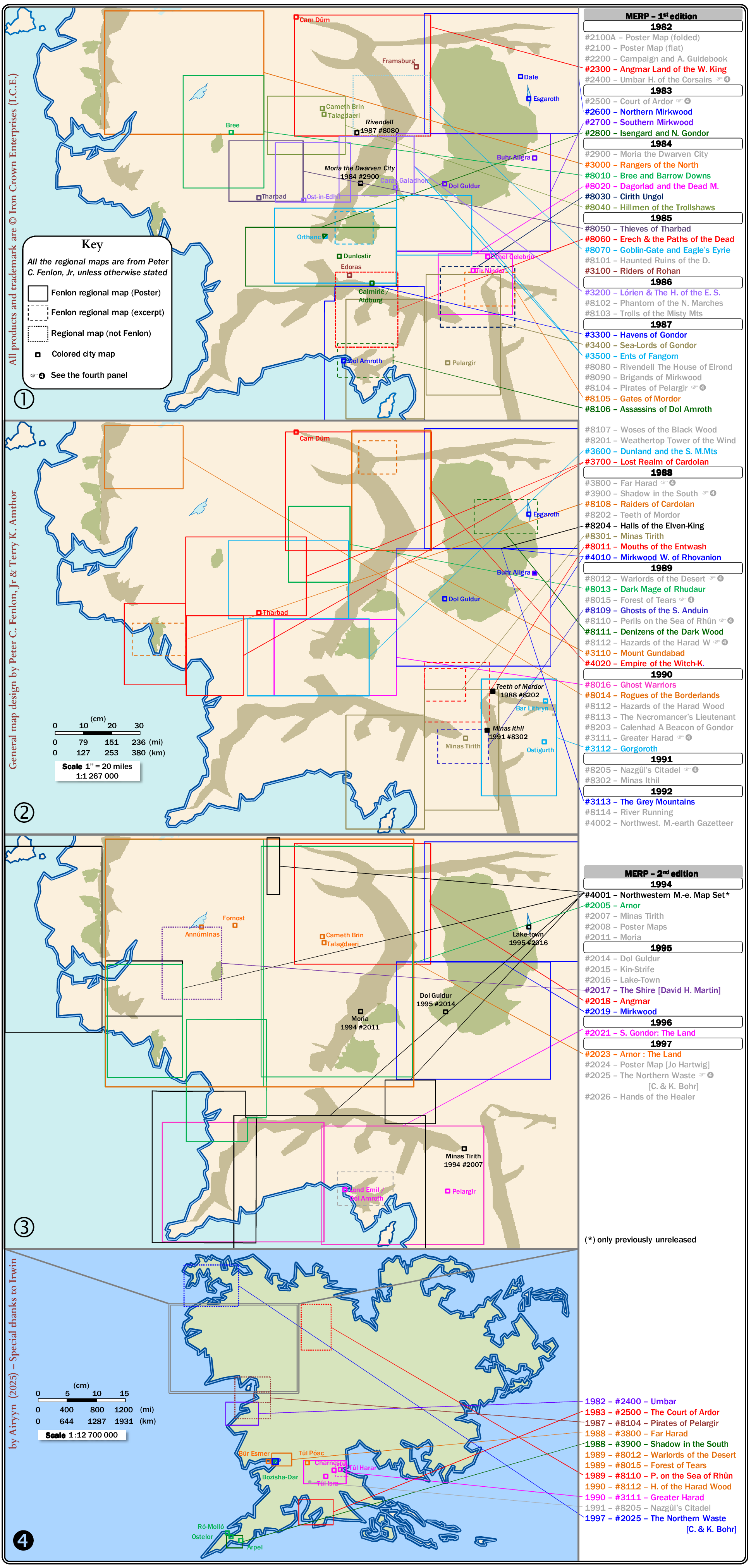 | 1,939 × 4,050 (1.24 MB) | Airyn (talk | contribs) |
You cannot overwrite this file.
File usage
The following 2 pages use this file: