
Size of this preview: 417 × 599 pixels. Other resolutions: 167 × 240 pixels | 334 × 480 pixels | 534 × 768 pixels | 713 × 1,024 pixels | 1,450 × 2,083 pixels.
Original file (1,450 × 2,083 pixels, file size: 476 KB, MIME type: image/png)
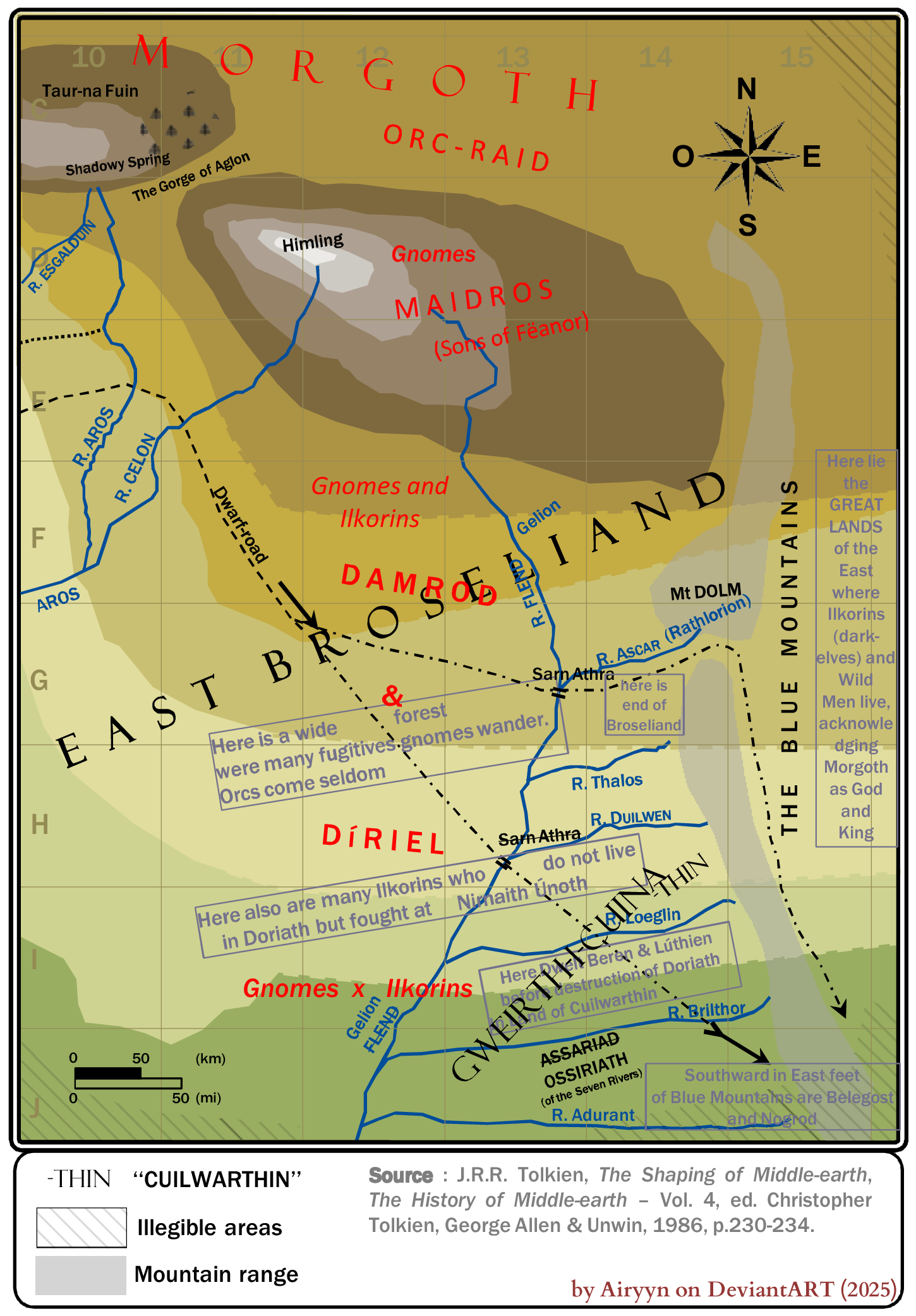
Summary
This infographic presents a colourised and cleaned version of the eastward extension of the 'First Silmarillion Map', made by User:Airyn. All information comes from this reference : J.R.R. Tolkien, The Shaping of Middle-earth, The History of Middle-earth – Vol. 4, ed. Christopher Tolkien, George Allen & Unwin, 1986, p.230-234.
Licensing
This work is licensed under the Creative Commons Attribution-ShareAlike 4.0 License.
Attribution: {{{1}}}
File history
Click on a date/time to view the file as it appeared at that time.
| Date/Time | Thumbnail | Dimensions | User | Comment | |
|---|---|---|---|---|---|
| current | 08:22, 29 September 2025 | | 1,450 × 2,083 (476 KB) | Airyn (talk | contribs) | This infographic presents a colourised and cleaned version of the eastward extension of the 'First Silmarillion Map', made by User:Airyn. All information comes from this reference : J.R.R. Tolkien, The Shaping of Middle-earth, The History of Middle-earth – Vol. 4, ed. Christopher Tolkien, George Allen & Unwin, 1986, p.230-234. |
You cannot overwrite this file.
File usage
The following page uses this file: