
Size of this preview: 441 × 599 pixels. Other resolutions: 176 × 240 pixels | 353 × 480 pixels | 565 × 768 pixels | 753 × 1,024 pixels | 1,856 × 2,522 pixels.
Original file (1,856 × 2,522 pixels, file size: 459 KB, MIME type: image/png)
Summary
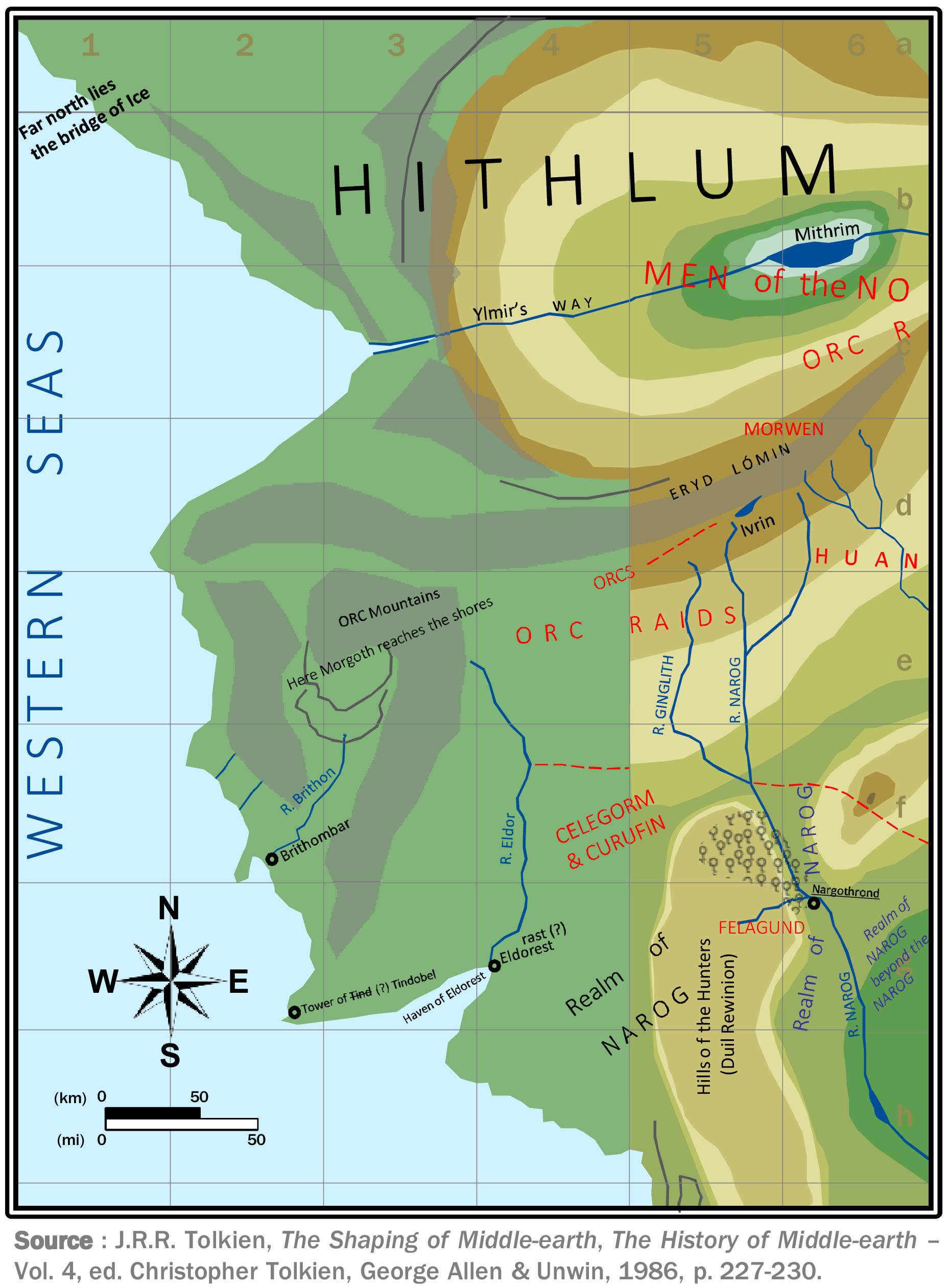
The ‘First Silmarillion Map’ - The Westward Extension New rendering by Airynn (personal work)
Source : J.R.R. Tolkien, The Shaping of Middle-earth, The History of Middle-earth – Vol. 4, ed. Christopher Tolkien, George Allen & Unwin, 1986, p. 227-230.
File history
Click on a date/time to view the file as it appeared at that time.
| Date/Time | Thumbnail | Dimensions | User | Comment | |
|---|---|---|---|---|---|
| current | 08:18, 16 May 2026 | | 1,856 × 2,522 (459 KB) | Airyn (talk | contribs) | The ‘First Silmarillion Map’ - The Westward Extension New rendering by Airynn (personal work) Source : J.R.R. Tolkien, The Shaping of Middle-earth, The History of Middle-earth – Vol. 4, ed. Christopher Tolkien, George Allen & Unwin, 1986, p. 227-230. |
You cannot overwrite this file.
File usage
The following page uses this file: